
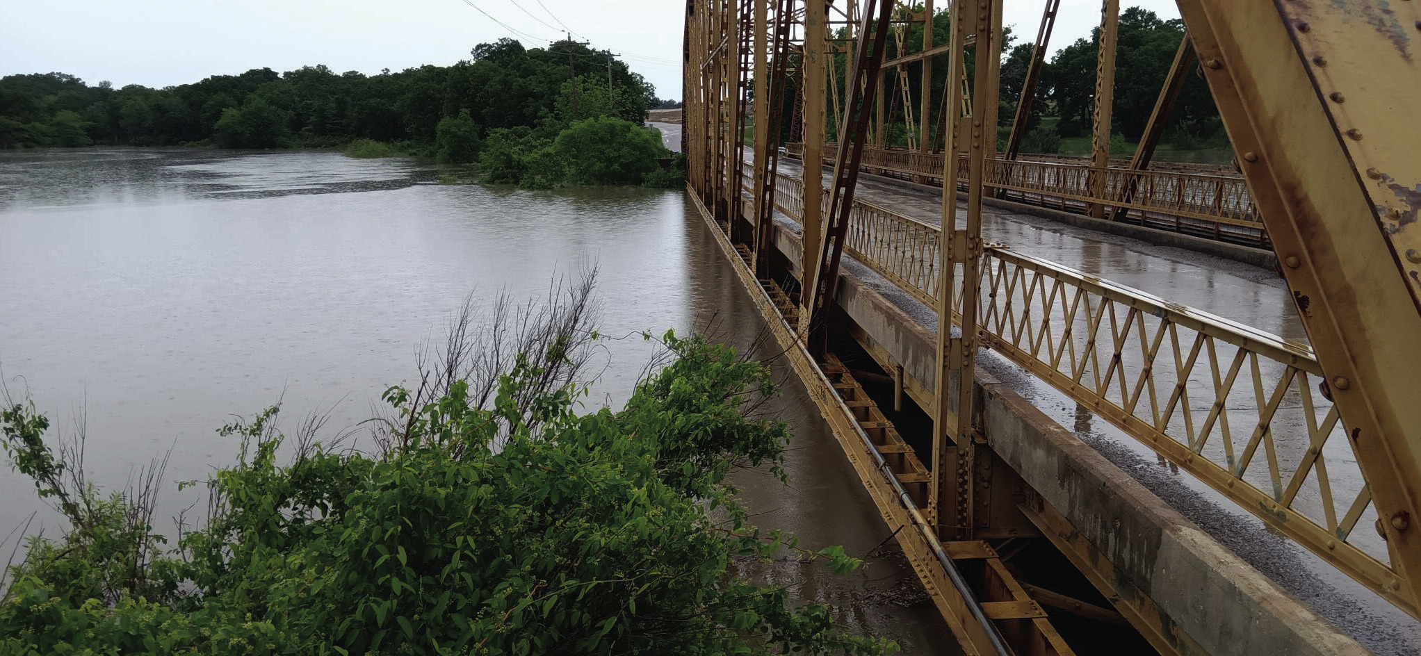
As summer approaches and Texomans are gearing up for some fun in the sun at the lake, there are some safety concerns about high water. As of May 5, 2025, Lake Texoma's water level has risen to 629.57 feet above mean sea level, placing it 12.57 feet above its conservation pool elevation of 617.00 feet. This elevation indicates that the lake is currently utilizing over 50% of its designated flood pool capacity.
The lake's elevation has been steadily increasing over the past few days. For instance, on May 3, 2025, the water level was recorded at 624.73 feet, and by May 4, it had risen to 626.83 feet.
This upward trend is attributed to significant inflows from recent rainfall events. As of May 5, the reservoir is releasing approximately 34,071 cubic feet per second to manage the elevated water levels Lake Texoma has a history of significant water level fluctuations.
Notably, the lake has crested its spillway, which is at 640 feet, five times: in 1957, 1990, 2007, and twice in2015. The highest recorded elevation was 645.72 feet on May 31, 2015.
In comparison, the current level of 629.57 feet, while elevated, remains below these historical peaks. The elevated water levels have several implications.
Flood Management: The U.S. Army Corps of Engineers is actively managing water releases to mitigate potential flooding downstream.
Recreational Activities: Boaters and visitors should exercise caution, as higher water levels can submerge hazards and increase debris in the water.
Infrastructure Impact: Prolonged high-water levels can stress dam infrastructure and affect shoreline properties. Lake Texoma's current water level reflects a significant rise due to recent rainfall, leading to the utilization of a substantial portion of its flood pool.
While the situation is being managed effectively, continued monitoring and adherence to safety advisories are essential for those in the vicinity. The rising water levels of Lake Texoma are significantly impacting Marshall County, particularly in areas like Kingston and Madill.
Heavy rain fall throughout April has elevated the lake's water level to approximately 622 feet as of early May, surpassing its typical conservation pool range of 615 to 619 feet. Despite the U.S. Army Corps of Engineers releasing around 34,000 cubic feet per second, the inflow is nearly 90,000 cubic feet per second, leading to continued elevation.
Marshall County could be impacted in certain areas like flooding of recreational spots, the elevated water levels have submerged beaches and recreational zones, limiting access for residents and visitors. Local residents have expressed concerns about the loss of play areas for children and pets.
There is a strain on local infrastructure, the marinas and businesses are adapting to the high-water conditions. For instance, Grandpappy Marina in Denison is actively communicating with customers to manage expectations and ensure continued access to boats.
There are also environmental concerns, the increased water levels can lead to shoreline erosion and habitat disruption, affecting local wildlife and ecosystems. The forecast for Marshall County indicates continued rainfall, which may exacerbate the situation.
Residents are advised to stay informed about weather updates and heed any advisories issued by local authorities. For real-time updates on Lake Texoma's water levels, you can monitor the U.S. Army Corps of Engineers' lake page.
The Marshall County Emergency Management Facebook page also warns about the rising water levels. It noted that “portions of Southern Oklahoma have Flooding Rivers , Creeks, Streams and other low-lying and flooding prone locations is imminent or occurring. Streams continue to rise due to excess runoff from earlier rainfall. Between 2-3 inches have fallen.”