
Photo courtesy of the Oklahoma Historical Society
mchistory24@gmail.com Rivalries are a fascinating aspect of human history and culture. They represent competition, conflict, and sometimes mutual respect between individuals, groups, or entities. They can be found in various fields, including sports, business, politics, and entertainment. Rivalries can inspire progress and innovation and foster community engagement, but they can also occasionally escalate into intense and lasting animosities. This series of articles will explore a rivalry that has existed for over 120 years. A rivalry that has sometimes been intense and has caused animosities that are renewed each school year.
At its core, a rivalry is a competitive relationship between two parties that strive for superiority in a particular domain. A desire for recognition, resources, power, or personal satisfaction can drive this competition. Rivalries often develop over time and can be fueled by previous encounters, perceived slights, or simply the pursuit of excellence. Rivalries can also shape the course of history and influence cultural narratives.
Such a rivalry has shaped the history and narrative of Marshall County. Since 1901, there has been a rivalry between Madill and Kingston that continues today. It started long before either town had a football team, and it was much more important and troublesome than any game played on the field. It divided families and friends, businesspartnersandchurch groups. And it ended up before the Supreme Court of Oklahoma.
This rivalry involved the battle between Madill and Kingston for the honor of being the county seat of the newly formed Marshall County. With the designation of “county seat,” the winning town also had the privilege of hosting the county courthouse.
The Marshall County Courthouse was the first site in Marshall County to be awarded placement on the prestigious National Register of Historic Places. The National Register of Historic Places, authorized by the National Historic Preservation Act of 1966, is the official list of historically significant sites in the United States, maintained by the National Park Service under the U.S. Department of the Interior. Its primary purpose is to recognize and protect historical, architectural, archaeological, and cultural properties. There are five sites in Marshall County on the National Register. They are the Courthouse, the Madill Professional Building (formerly the Hollingsworth Building), the U.S. Post Offi ce, the Oakland School, the J. H. Bounds Barn, and the Haley Point Archeological Site near Lebanon.
But before we get to the courthouse story, it would be helpful to review the history of what we today know as Oklahoma.
In 1830, Congress passed the Indian Removal Act, which allowed President Andrew Jackson to remove the Native Americans from Southeast North America. In 1831, with the Treaty of Dancing Rabbit Creek, the Choctaw people were forced from their ancestral lands in Mississippi. The Seneca, Shawnee and Ottawa also were part of this removal.
In 1832, the Treaty of Payne’s Landing began removing the Seminole people from Florida. Also, in 1832, the Treaty of Pontotoc Creek in Mississippi required the removal of the Chickasaw from their lands. Then, the Sac and Fox Nation, the Prairie Band of Potawatomi people, and the Shawnee and Delaware tribes ceded lands for land in Kansas. Other tribes ceded their lands for land in Illinois and Missouri. The small nations of Stockbridge, Munsee, Brotherton and New York Oneida ceded lands and were relocated to the northeast corner of Indian Territory. In 1833, the Quapaw of Arkansas were removed to Indian Territory, and the Apalachicola of Florida (part of the Muscogee- Creek Confederacy) also began removal. Also, in 1834, the Muscogee Nation began removal. In 1835, The Treaty of New Echota provided for removing all Cherokees east of the Mississippi River, and the Seminoles of Florida began removal, as did the Muscogee and Creek.
Then, in 1837, the Chickasaw National voluntarily left their ancestral lands and settled on the western fringe of the Choctaw Nation in Indian Territory. In 1838, the forced removal of 16,000 Cherokees began. In 1839, the Cherokee Trail of Tears continued, incurring approximately 4,000 deaths along the way, and in 1842, FortWashitawasestablished in Indian Territory.
By 1867, Indian Territory was reduced to the areas in present-day Oklahoma, and the Sac and Fox were removed from Kansas to the Indian Territory along with the Citizen Potawatomi Nation. Then, the Treaty of Medicine Lodge was concluded, reassigning the Cheyenne and Arapaho reservations to the Indian Territory. In 1871, the Osage in Kansas purchased land from the Cherokee Nation, creating the Osage reservation in present-day Osage County. In 1874, the Pawnee were removed from Nebraska and moved to the Indian Territory. Between 1877 and 1880, the Ponca wereremovedfromNebraska and moved to the Indian Territory, and the Iowa were removed from Nebraska and Kansas and moved to the Indian Territory.
Thisledtothe1887General Allotment Act, authored by US Senator Henry L. Dawes. The Dawes Severalty Act (General Allotment Act) legislated the allotment of communal tribal lands into individually owned tracts of land. To aid in the full assimilation of its Indian population, the U.S. Congress created the Dawes Commission in 1893. Another congressional law, enacted on June 28, 1898, was sponsored by Charles Curtis, a mixed-blood Kansa Indian and senator from Kansas. With the passage of the Curtis Act, Congress took final control over affairs in Indian Territory.
The Curtis Act helped weaken and dissolve Indian Territory tribal governments by abolishing tribal courts and subjecting all persons in the territory to federal law. This meant that there could be no enforcement of tribal laws and that any tribal legislation passedafter1898had to be approved by the president of the United States. Towns could be surveyed and incorporated under the act, andresidentswerepermitted to vote. The establishment of public schools was also sanctioned.
With the passage of the Curtis Act, Congress authorized theDawesCommission to prepare new citizenship rolls for each tribe. Sen. Henry L.DawesofMassachusetts compiled a census to be used as the basis for the allotment of tribal lands to individual Indians. The ensuing allotment was performed without tribal consent.
The Curtis Act dealt a blow to the governmental autonomy of the Five Tribes. Still, the act was merely the culmination of legislation designed to strip tribal governments of their authority and give it to Congress or the federal government. Ironically, Charles Curtis, himself of Indianblood,wasresponsible for the act that helped pave the way for the demise of the Indian nations. The Dawes Act was passed by Congress, thus establishing the Dawes Commission and the beginning of the plans to dismantle IndianTerritory. In1889,the Unassigned Lands in what is now Oklahoma were opened to settlement in the first of five land runs. This led to the establishment of The Oklahoma Territory in 1890.
The ultimate purpose of the Curtis Act was to pave the way for statehood for the combined Indian and Oklahoma Territories. The Act provided an eight-year time frame for abolishing tribal governments, with the plan for statehood commencing in 1906. Following this, a Constitutional Convention was formed.
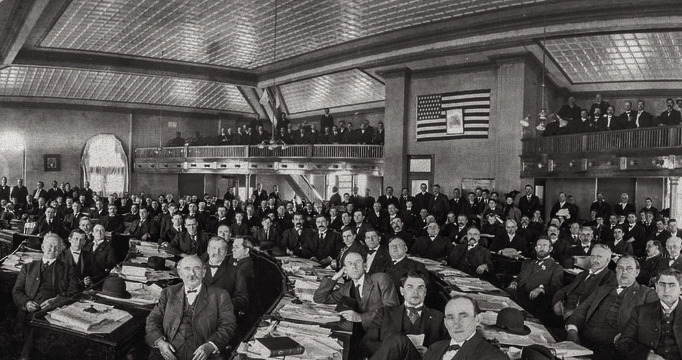
After the Enabling Act of 1906 allowed Oklahoma Territory and Indian Territory to become a single state, 112 elected delegates met in Guthrie from November 20, 1906, until March 15, 1907. The delegates, led by William “Alfalfa Bill” H. Murray, were tasked with drafting a constitution to be put before the public for approval at an election planned for September 1907.
One of the major tasks of the writers of the Oklahoma Constitutionwastodesignate counties and county seats. The process was contentious, and everyone on the county committee had opinions about boundary lines and principal cities. In addition, thecommitteememberswere subjecttocompetingrequests from leaders of various towns being considered for the location of county offices.
While some of the most strident lobbying in the Constitutional Convention was over selecting county seats, the winners were often unpopular. While the delegates oversaw identifying where county governments would be located, there were, in some instances, strong disagreements and outright rebellion. Therefore, the committee declared that elections could be conducted in each county after statehood to satisfy these competing interests. However, at the final ceremony at Guthrie on November 16, 1907, officials designated the location of counties, their boundaries and the seat of each county government.
One of the Oklahoma Constitutional Convention delegates was George Allen Henshaw. Henshaw was born on October 2, 1867 in Stonefort, Illinois. At nineteen, he entered college at Crab Orchard, Illinois. His goal was to become a lawyer, but he taught school for several years until he entered the Indiana College of Law, a department of Valparaiso University. He completed law school in 1894 and practiced law in Illinois for six years.
In 1900, Henshaw moved to Pickens County, Indian Territory and settled in the new town of Madill. In addition to practicing law in Madill, he was elected to the Madill School Board, where he served for several years. Because of his popularity and integrity, the people of Madill selected him to serve the area as a delegate to the Constitutional Convention.
Once a delegate to the convention, Henshaw moved to the Guthrie area. There, he became friends with William H. (Alfalfa Bill) Murray, Charles Haskell and others. Because of his integrity and popularity, he was named chairman of the Legal Advisory Committee. He was so well respected that following statehood, Henshaw was named Assistant Attorney General under the first Oklahoma Attorney General Charles West and was selected general counsel for the Oklahoma Corporation Commission.
Henshaw was also placed onthecommitteetaskedwith establishing and naming the 75 counties of the new state. When it came time to name the county containing Madill, Henshaw successfully convinced thecommitteetoname the new county Marshall after his mother, Elizabeth Ellen Marshall. Henshaw’s mother, Elizabeth Marshall, was a relative of John Marshall, the Chief Justice of the United States Supreme Court. In 1910, Henshaw was elected to the Oklahoma Corporation Commission, where he served until 1917. He died in 1947 after a long and celebrated career in the early days of Oklahoma.
Becauseofcontinuedstrife in many counties, wherein many cities and towns were eager to challenge the county seat designations of the Constitutional Convention, the first state legislature finally laid down the rules for county seat elections. In 1908, Senator J. Elmer Thomas of Lawton offered a bill that made it easy for citizens to call an election to change county seats. It provided that the governor could call an election on a petition signed by 25 percent of a county's voters, requiring the governor to call an election. The law required that the county seat could be removed on a majority vote except in instances in which the original county seat was within six miles of the county's geographical center.
In those cases, the law required a sixty percent vote for removal unless the contesting town was at least one mile nearer the county's geographical center. In that case, only a majority vote was needed to move the county seat.
The law also provided that no county could expend funds for a courthouse or permanent improvements before April 1, 1909, unless it had first voted on a county seat location. Once a county seat was established under this procedure, there could not be another such election for at least ten years.
Governor Charles Haskell approved Senator Thomas’s bill in April 1908, and because of this, within months, elections were held in 72 of the 75 counties designated by the Oklahoma Constitution. The result of those elections saw at least eight county seats chosen by the convention being eliminated by county voters.
Some disputes were quite heated before, during and after the vote. In the Creek County election, both Bristow and Sapulpa residents courted the votes of the folks in Keifer, where several illegal taverns were in operation. Keifer had very little law enforcement, and the joint operators favored Bristow because its police force was farther away from their town than Sapulpa. The matter ended up in court, and Keifer’s votes were all thrown out, leaving Sapulpa as the county seat.
Delaware County residents were conflicted when state authorities designated Grove as the county seat. Because Delaware County is large at 792 square miles, opponents argued that the county seat should be closer to the center and further south. While the argument had some validity and a vote was scheduled, Grove proponents were confident that Grove was the only option; therefore, complacency led to many people failing to vote. Whenthetallywasmade, Grove lost by 100 votes. Thereafter, protests were lodged but failedandin1911,theSupreme Court ruled in favor of a new site approximately 10 miles south called Jay. The problem was that Jay existed as two towns called Old Jay and New Jay. So, a line was drawn down the road that divided the two towns and around 500 shots were fired before the matter was settled and New Jay secured the county courthouse.
Supporters then built a wooden structure to house official documents, but the controversy took on new life when records were not removed from Grove. Legal wrangling ultimately resulted in Governor Lee Cruce ordering the state militia to enforce the ruling. Traveling by train, the troops remained at Afton while authorities negotiated. Ultimately, cooler heads prevailed, the records were moved, and Jay became the new county seat.
The McIntosh County dispute also ended in gunfire, and it was the only one that ended with someone being killed. The constitutional convention committee had recommended Checotah for the county seat, but the full convention delegates chose Eufaula. In the election, Checotah won the vote, and several men from that town traveled by train to Eufaula to seize the county records. Eufaula residents realized whatwashappeningand gathered with guns. Sadly, two men were killed before cooler heads prevailed. Thereafter, the Supreme Court threw out the first election, and a second election awarded the county seat to Eufaula.
In Ottawa County, many citizens were unhappy with the selection of Miami as the county seat. They considered Miami a “whiskey town, full of bars and rife with other vices.” So, in January 1909, a group of citizens filed suit to incorporate and develop a new town called Hilburn on a vacant plot of land furtherwest,moreinthecenter of the county. However, their promise to develop two public squares for county buildings did not sway most voters, and the final tally of the election to move the county seat failed by a vote of 1,072 to 1,544, ensuring the county seat would be “whiskey town.”
Aspiritedcontestalsodeveloped in Wagoner County. The state was barely recognized in November 1907 when the Coweta Courier announced its selection as the official county newspaper. A few months earlier, Wagoner County citizens had approved the construction of a courthouse in Wagoner, with the assumption that it would also be the location of the county seat.
Because of this, the Wagoner business community raised money, purchased the one toll bridge across the Verdigris separatingWagonerand Coweta, and made it free to get the farmers' vote. Further, they touted the fact that rent would only be $100 a month for space in their courthouse, whereas the expense of a new state building in Coweta would run between $50-$100,000. The public was swayed. Wagoner garnered 1,996 votes to Coweta’s 1,482.
There was also dissatisfaction among Adair County residents when Westville was designated as the County Seat, as many county residents preferred Stilwell because it was more centrally located. A vote wasscheduledforJune2,1908, and 101 votes chose Stilwell. Thereafter, voter fraud was charged, and a special referee was appointed. After a twoyear investigation, Westville was still recommended. Stilwell supporters then filed suit, and the Oklahoma Supreme Court ordered another election on February 24, 1910. Stilwell supporters prevailed by 30 votes, and although the results were contested, county records were moved to Stilwell.
In other county elections, Kenton lost to Boise City in Cimarron County, Lehigh lost to Coalgate in Coal County, Pond Creek lost to Medford in Grant County, Ryan lost to Waurika in Jefferson County, and Tecumseh lost to Shawnee in Pottawatomie County.
In addition to the 72 elections to designate the county seat of each county, there were also three elections to add additional counties. In one election, Harmon County was created in 1909 out of Greer County. In another election in 1912, Comanche County was split, and part became Cotton County. Then,therewastheeffort to create Swanson County, which soon disappeared from the map. But before it disappeared, it made a lot of news.
Citizens of parts of Comanche and Kiowa counties voted to become Swanson County in 1910. The county was named after Claude A. Swanson, governor of Virginia and later secretary of the Navy. Mountain Park and Snyder (both in the Kiowa part of the new county) contended for county seat honors. Then Governor Charles Haskell selected MountainParkbylotinissuing his proclamation to recognize the county. However, all the elected county officers except the sheriff moved their offices to Snyder. They said Mountain Park had not kept its promises to provide adequate facilities for the courthouse.
'Following the 1910 general election,' Irvin Hurst, in his 1957 book The 46th Star, wrote, 'Sheriff W.E. Brashears sent deputies out in January to round up the (three) county commissioners and take them to Mountain Park to approve his bond. A farmhand was killed when the deputies sought forcibly to take C.E. Bull, chairman of the board, to the official county seat.' There is no telling how many officeholders and innocent bystanders would have been killed if the Oklahoma Supreme Court had not entered the picture. It ruled the Comanche part of the new county vote insufficient. 'Swanson County officials were forced to surrender their records under district court proceedings,' Hurst wrote. In 1910, after all the dust had settled, Oklahoma had 77 counties.
While no one was shot or killed, the rivalry between Madill and Kingston for the title of county seat was heated and contentious. Issues of size, geographic center and more would eventually play a huge role in the battle between Madill and Kingston.
Inthecomingweeks,wewill discuss this rivalry that began in 1907 and, in various ways, continues today.